The Booth archive at London School of Economics have given me permission to publish copies of their maps in my book and to use the maps for exhibitions (with a suitable credit of course).
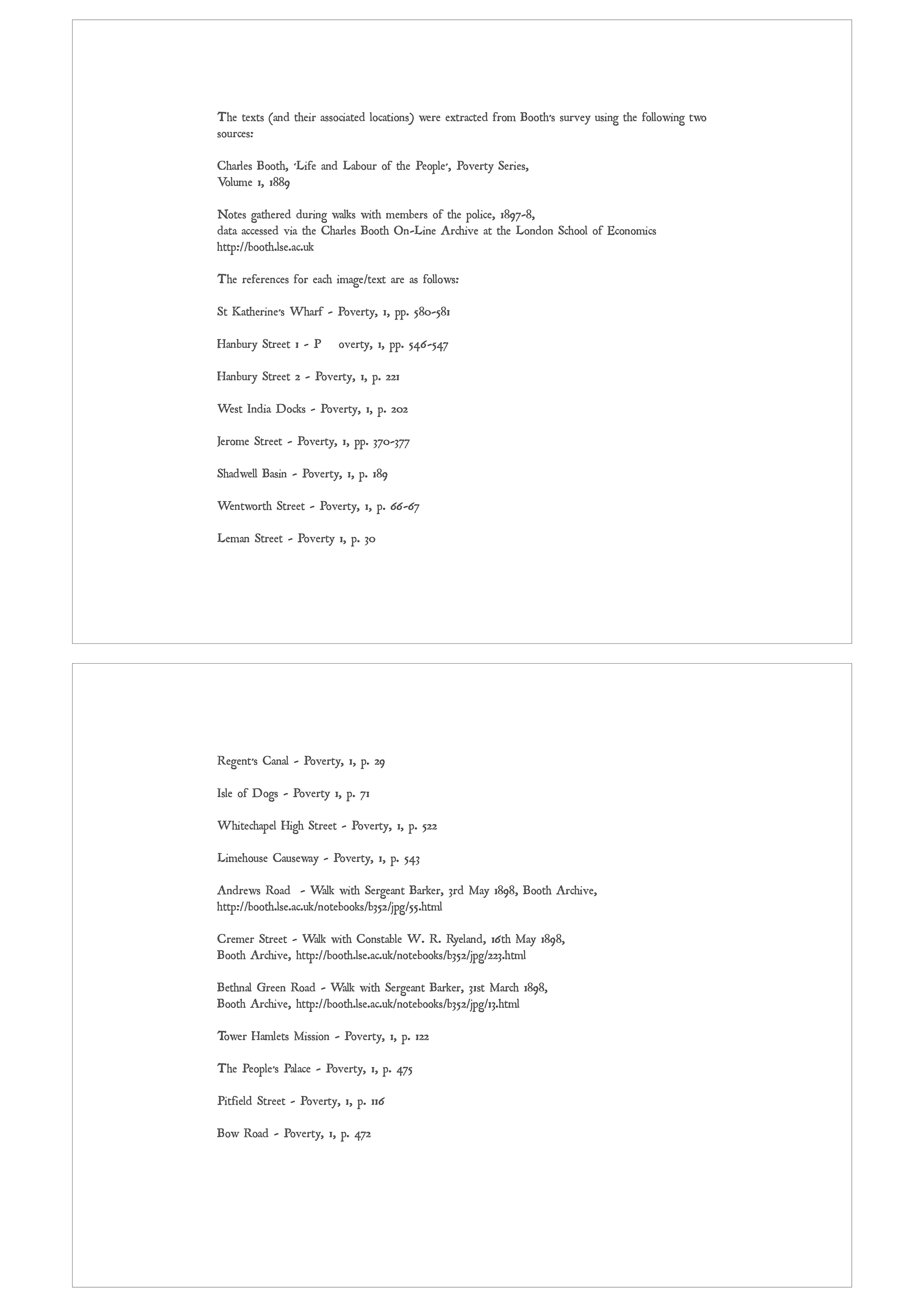
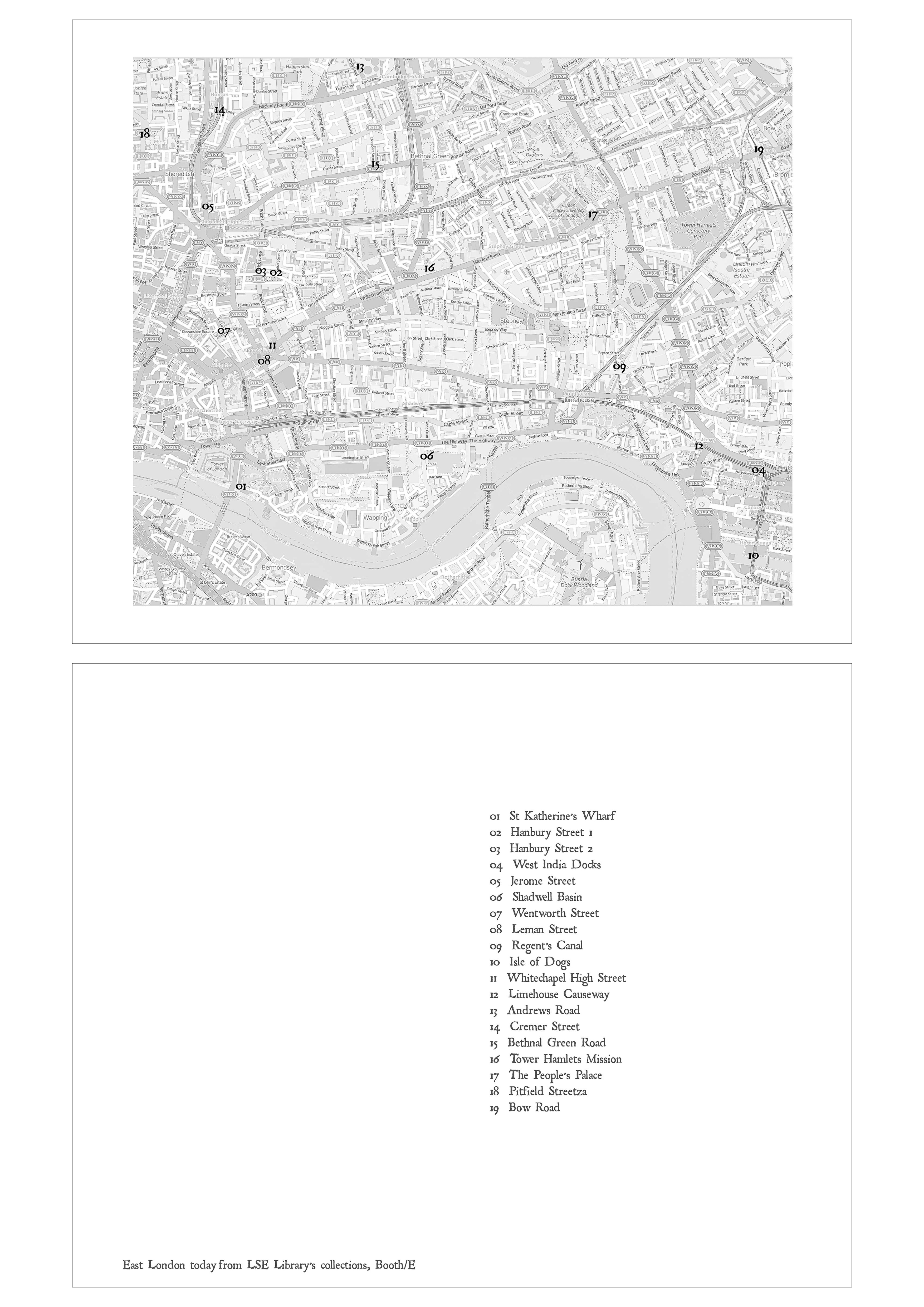
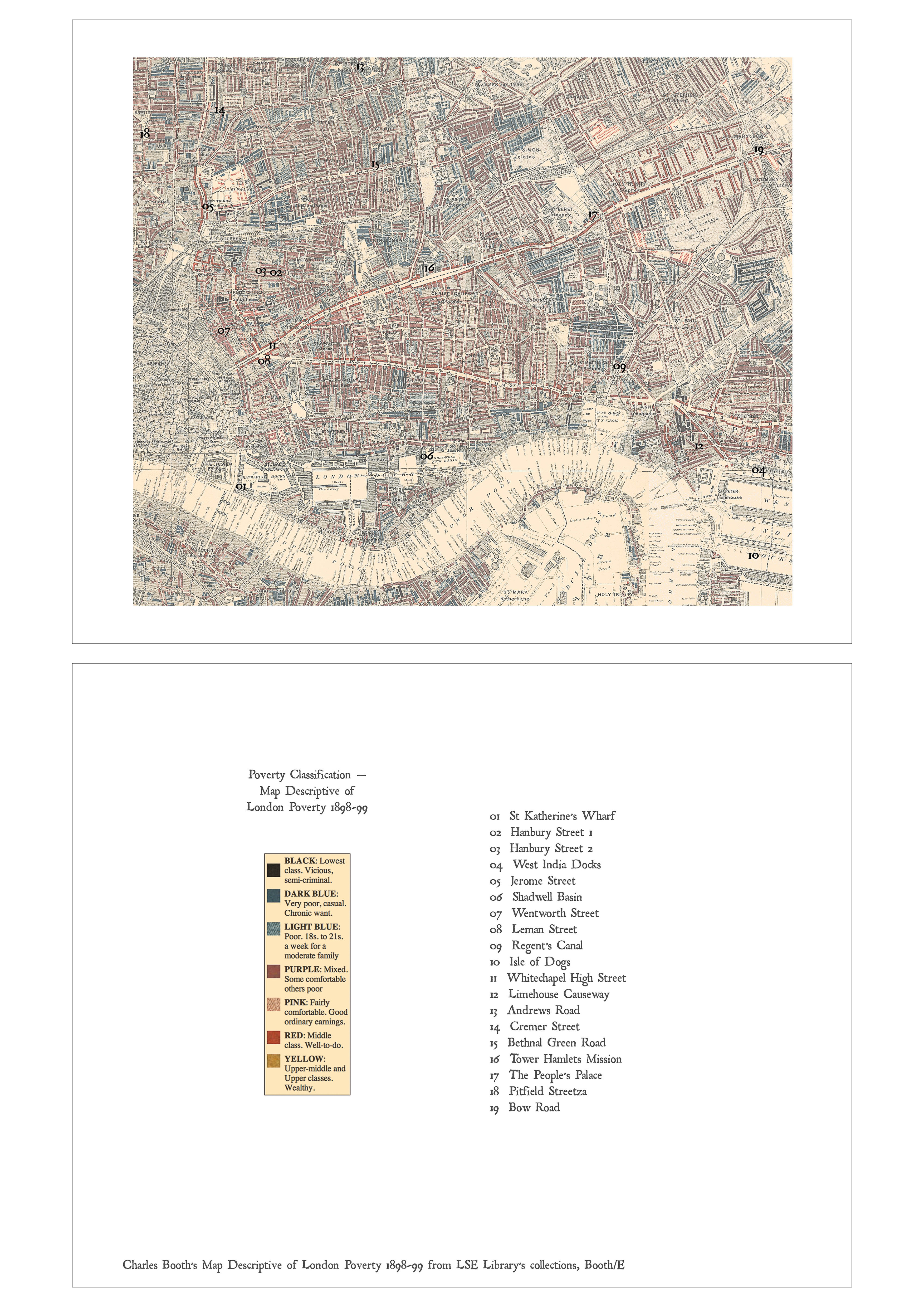
I have been mapping out (excuse the pun) how this would look in book format. Here are sample pages from a book layout. These pages would appear at the rear of the book. The references give the locations, the source of each text and shows the locations on both a modern day map and on Booth’s 1898-9 ‘Descriptive Map of London Poverty’. A key to interpret the poverty map is also given. The pages are presented in pairs which will be on facing pages in the book.
©Keith Greenough 2014
©Keith Greenough 2014
©Keith Greenough 2014
In principle this works well, but in practice the text on the maps is very small. The full size images (click on the image to see these) are sized to the size of the book – each is 8×10 inches. I don’t think it matters too much that the detailed street names are hard to read. What is important is that the general location is shown and that one can see how close to the ‘black’ poorest areas on the Booth map my locations are. Would be interested in feedback on this presentation.


jsumb
November 2, 2014
I was thinking about this yesterday Keith as there was a programme on maps that had a large section of the programme devoted to Both and his methods/results etc. Fascinating stuff. Well done on getting permission
Keith Greenough
November 2, 2014
I saw the maps tv show last week. Pity I missed the Booth one….must catch up with this on iPlayer….
Catherine
November 2, 2014
good progress there. I’m even imaging ‘guided walks”!
Keith Greenough
November 2, 2014
Not sure about the guided tours….there are plenty of people offering these already!!