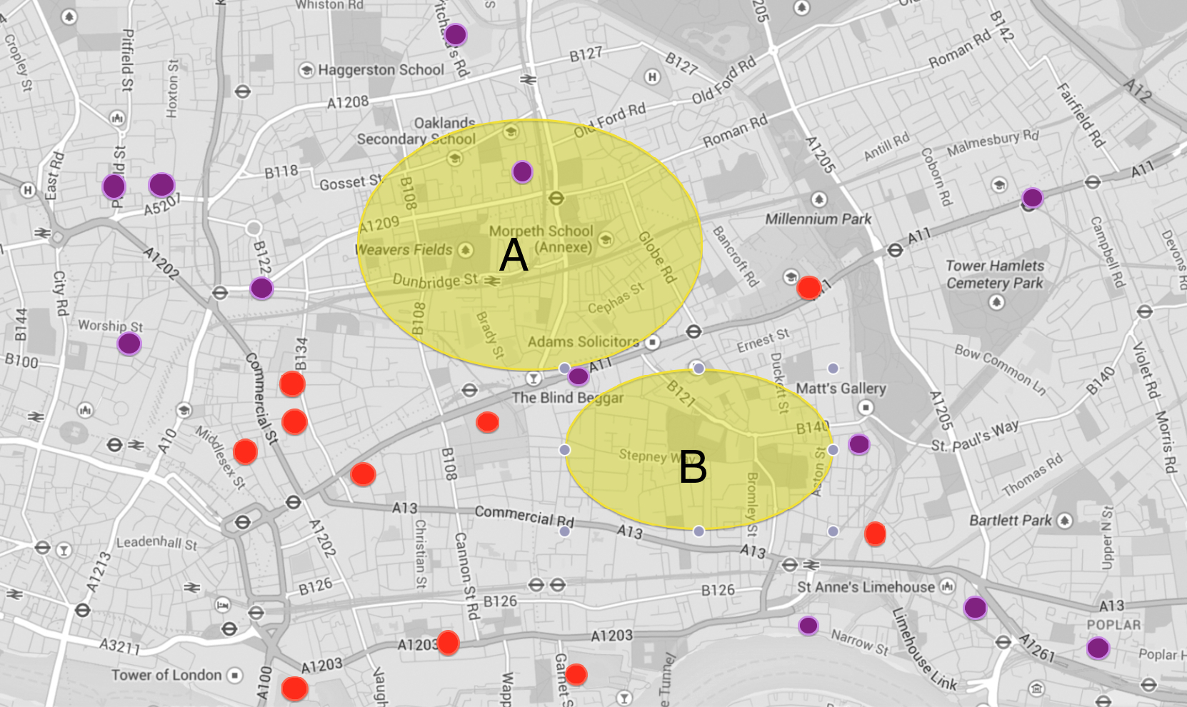
Below is a map of the current state of play in terms of the geographic locations of the urban landscapes I am looking to make for my East London project. The red dots are locations where I have a text and have made a photograph which I am happy with (at least for now). The purple dots are locations where I have a text and have made a reconnaisance but have not yet made a satisfactory photograph. The yellow areas are currently relatively barren zones for which I need to do more research. Zone A is in effect Bethnal Green and Zone B is Stepney along Commercial Road.
Map of Booth locations for East London project


Posted on May 15, 2014
0